
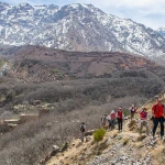






Morocco is famous for its colourful markets, historic cities, and desert landscapes. But beyond the busy streets, enormous mountain ranges stretch across the country, offering some of North Africa's most beautiful scenery.
The Atlas Mountains are home to traditional Amazigh villages, deep valleys, rocky peaks, and walking trails. Some areas are easily reached from Marrakech, while others require longer journeys through remote mountain roads.
For travellers planning a hiking holiday, understanding the geography makes a real difference. Mountain ranges, village locations, road connections, and elevation changes all influence where you can go and how much time you need.
An atlas mountains map helps visitors understand the region before setting off. It shows how Morocco's mountain ranges connect, where popular trekking destinations are located, and which routes may suit different experience levels.
Where Are the Atlas Mountains Located?
The Atlas Mountains extend across Morocco, Algeria, and Tunisia, covering approximately 2,500 kilometres.
In Morocco, the mountains form a major part of the country's landscape. They separate many coastal and northern regions from the drier areas towards the Sahara Desert.
The Moroccan Atlas system includes three main ranges: the High Atlas, Middle Atlas, and Anti-Atlas.
Each has its own landscapes, climate, and travel opportunities.
What Are the Main Mountain Ranges in Morocco?
High Atlas Mountains
The High Atlas contains Morocco's highest peaks and some of its best-known trekking routes.
Mount Toubkal, reaching 4,167 metres, is the highest mountain in Morocco and North Africa. It attracts hikers interested in mountain scenery and challenging summit walks.
The High Atlas also contains traditional villages, terraced farmland, and dramatic valleys.
Middle Atlas Mountains
The Middle Atlas lies farther north and is known for forests, lakes, and rolling mountain landscapes.
Areas around Ifrane and Azrou offer a different experience from the rocky High Atlas. Cedar forests and cooler temperatures make this region attractive for nature lovers.
Anti-Atlas Mountains
The Anti-Atlas stretches across southern Morocco.
Its landscapes include rugged hills, rocky formations, and traditional villages. The region around Tafraoute is particularly known for its striking granite scenery.
How Can an Atlas Mountains Map Help You Plan a Trek?
A good map provides more than place names.
It helps you understand distances, mountain passes, elevation changes, and the relationship between villages and walking routes.
When examining an atlas mountains map, look for contour lines, marked trails, water sources, and access roads.
Elevation matters.
A route that appears short on a flat map may involve several hours of climbing. Mountain paths can also be harder to follow than roads shown on ordinary navigation apps.
For serious hiking, use detailed topographic maps alongside local route advice.
Where Is Mount Toubkal on the Map?
Mount Toubkal is located in Toubkal National Park, within the High Atlas Mountains south of Marrakech.
The village of Imlil is a popular starting point for trekking in this area.
From Imlil, routes lead towards mountain villages, valleys, refuges, and higher trails around Toubkal.
The summit trek requires good fitness and preparation. Snow, ice, altitude, and changing weather can make conditions more difficult, particularly during colder months.
Travellers should check current access rules and guide requirements before beginning a climb.
Which Atlas Mountain Routes Are Popular With Visitors?
The Imlil Valley offers walks through mountain settlements and terraced agricultural landscapes.
The Azzaden Valley is another appealing destination, with quieter paths and views of traditional villages.
For experienced hikers, multi-day routes around the Toubkal massif provide more demanding terrain.
An atlas mountains map can help travellers compare these areas, but the most suitable route depends on fitness, weather, available time, and hiking experience.
Not every visitor needs to climb a summit.
A relaxed village walk can be just as memorable as a demanding mountain trek.
How Can Local Trekking Knowledge Improve Your Trip?
Maps provide geographical information, but local knowledge adds useful practical detail.
mttoubkaltrek focuses on trekking experiences around Mount Toubkal and Morocco's Atlas Mountains. Its mountain-focused travel services help visitors explore routes, villages, and scenic landscapes while considering the practical needs of a trekking trip. For travellers unfamiliar with the region, local guidance can make route planning and preparation more straightforward.
Understanding the terrain before travelling is especially helpful when visiting remote mountain areas.
When Is the Best Time to Explore the Atlas Mountains?
Spring and autumn are popular seasons for mountain walking.
During these periods, many lower and middle-elevation routes can offer pleasant hiking conditions. Temperatures still vary considerably with altitude.
Summer can bring strong heat in lower valleys, while higher elevations may remain cooler.
Winter is different.
Snow and ice can affect mountain passes and summit routes, making specialist equipment and experience necessary in some areas.
Always check local forecasts and trail conditions before departure.
What Should You Check Before Using a Mountain Map?
First, confirm that the map is suitable for hiking rather than general sightseeing.
Detailed maps should show elevation, trails, settlements, and significant terrain features.
Offline navigation is useful because mobile coverage can be unreliable in remote valleys.
Carry enough water, suitable clothing, and a realistic route plan.
An atlas mountains map is a valuable planning tool, but it should never replace awareness of actual conditions on the mountain.
Conclusion
Morocco's Atlas Mountains offer everything from forest walks to demanding high-altitude treks.
Understanding the differences between the High Atlas, Middle Atlas, and Anti-Atlas helps travellers choose destinations that match their interests.
With a reliable atlas mountains map, suitable preparation, and an understanding of local conditions, visitors can explore this remarkable mountain region with greater confidence.
Frequently Asked Questions
Where do the Atlas Mountains start and end?
The Atlas Mountains stretch across northwestern Africa, passing through Morocco, Algeria, and Tunisia. Morocco contains several major ranges, including the High Atlas, Middle Atlas, and Anti-Atlas.
Can beginners hike in the Atlas Mountains?
Yes. Some valleys and village trails are suitable for beginners, while high mountain routes require greater fitness and preparation. Choose a walk that matches your experience.
Is Mount Toubkal close to Marrakech?
Mount Toubkal is located south of Marrakech in the High Atlas. Travellers commonly reach the trekking area through Imlil, which serves as a starting point for many mountain routes.